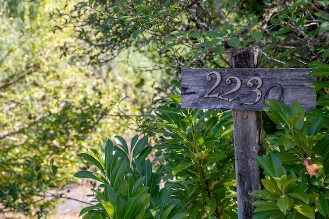

A sign in front of 2230 Doaks Ferry Road on Thursday, Sept. 23, 2021. (Amanda Loman/Salem Reporter)
When Ken Bierly looked at the property where a subdivision is proposed in west Salem, it was obvious there was a stream.
Looking on from Northwest Doaks Ferry Road, he saw depressions in the land on each side near Straub Nature Park. After spending 13 years working at the Department of State Lands as a wetlands program manager, he knew what to look for.
“Anybody who’s observant about the land could tell there’s something that would likely drain water from one area downstream,” said Bierly, who’s the chair for the Glenn Gibson Creek Watershed Council.
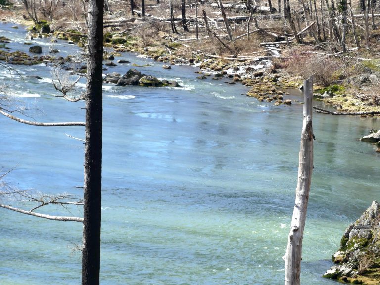
But Bierly said the tributaries to Wilark Brook, which feeds into Gibson Creek and eventually the Willamette River, aren’t identified in city maps.
An application submitted to the city of Salem shows Multi/Tech Engineering plans to build a 27-lot subdivision and remove a few trees in the riparian area of the unidentified tributaries.
If the tributaries were identified in city maps, the planned development would go against a city law that prohibits removing trees or native vegetation within 50 feet of a riparian buffer.
Bierly said not preserving the riparian area could cause the water temperatures to rise downstream and have detrimental impacts on native fish like cutthroat trout or steelhead salmon.
The West Salem Neighborhood Association and Glenn Gibson Creek Watershed Council appealed the project’s approval on June 16 and 15, respectively, but ultimately lost their appeal during a Sept. 7 planning commission meeting.
Steve Andersen, West Salem Neighborhood Association land use chair, said they don’t oppose the subdivision but want the stream preserved.
“This is an urban stream. It has value. You can build there, and you can put some trails and stuff in the area, create a nature area for the neighborhood,” he said. “In an urban environment we think the neighborhood should grow and as you infill, we understand there’s going to be some adjustments but we think that this urban environmental buffer area should be preserved.”
Mark Grenz, CEO of Multi/Tech Engineering, said developers went onsite and identified an additional area where surface water was running toward the creek and redesigned the subdivision to stay away from it.
He said no one asked them to, and it wasn’t required under planning guidelines.
“(Developers) don’t just hope nobody sees something and cover it up, they try to follow the rules and make an effort to protect those things that need to be protected,” he said.
But he said he wouldn’t characterize the drainage areas as waterways.
“If you start defining a waterway as anything that carried water, every roadside ditch is a waterway,” he said.
He said they have followed all the city’s development codes and statutory requirements.
He said development has gotten significantly more expensive in the last two years. He said creating lots used to cost around $110,000. Now, it’s costing anywhere from $150,000 to $170,000 to develop a lot because of land prices and construction costs skyrocketing.
He said developers have to make the best use of the land and “from a cost standpoint that’s still developable when you get there.”
The issue has highlighted a broader debate, which is how Salem will protect its natural resources in the future, especially as the city plans for tens of thousands of new residents. Polk County, where the development is proposed, was the third-fastest growing county in Oregon, according to the most recent Census data.
Through a statewide planning objective called Goal 5, local governments are asked to create inventories to preserve natural resources like waterways, wildlife habitat, historic resources, among others, as they develop.
But Salem doesn’t currently have such a plan.
Lisa Anderson-Ogilvie, Salem planning administrator, said creating one is an intensive project, requiring planners to inventory streams, lakes and other natural resources and create a plan on how to protect them.
When the city first started its comprehensive plan update after Salem City Council approved funding in 2017, city planners determined they didn’t have sufficient funding or staff to include Goal 5 planning, Anderson-Ogilvie said. The update, called Our Salem, is meant to guide growth in the city for the next 20 years.
“We can’t do it right now, but we know it needs to be done and its related,” she said.
She said a Goal 5 inventory would likely come after other priority projects like a transportation systems and parks master plan updates.
Anderson-Ogilvie said it’s not that the city is disputing the creek’s existence. She said the developer will have to go through an additional permitting process through the Army Corps of Engineers and Department of State Lands that would identify a creek if it’s there.
In that case, the developer would have to modify the subdivision to preserve the riparian buffer.
“It’s not that city staff are saying, ‘No, there’s no creek there, we don’t know,’” she said. “It’s not our job to determine that through this application.”
Contact reporter Saphara Harrell at 503-549-6250, [email protected].
JUST THE FACTS, FOR SALEM – We report on your community with care and depth, fairness and accuracy. Get local news that matters to you. Subscribe to Salem Reporter starting at $5 a month. Click I want to subscribe!