New state fire risks map leaves property owners with insurance concerns; some cities challenge data
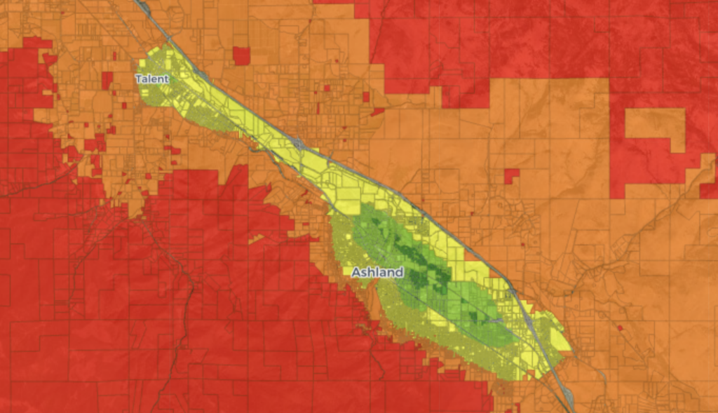

A new map from the Oregon Department of Forestry shows Ashland as an island of low-fire risk in a sea of high risk. Chris Chambers, the wildfire division chief with Ashland Fire & Rescue, said he disagrees with some of the areas the new map shows as low risk. (Oregon Department of Forestry/Screen Shot of Oregon Wildfire Risk Explorer)
Juliet Grable and her husband bought their house near Ashland in 2014. The property is surrounded…