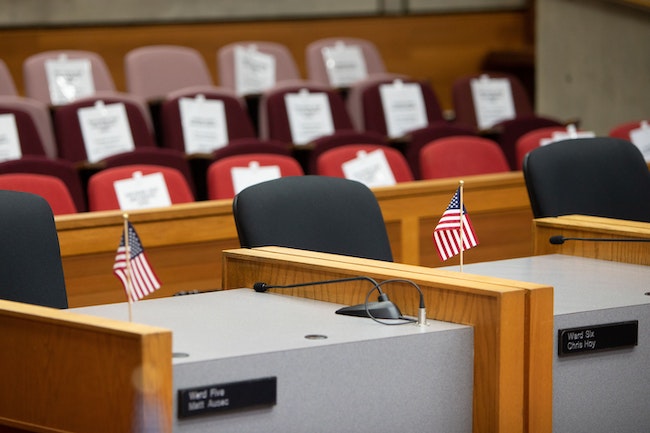

Salem city council chambers on Wednesday, September 30, 2020. (Amanda Loman/Salem Reporter)
Salemites could soon find themselves represented by a new city councilor.
The Salem City Council on Monday will consider three new maps to determine which councilor represents which residents. They will select a final alternative later this month.
The new map could go into effect as soon as January.
The Mid-Willamette Council of Governments analyzed the latest Census data and prepared three alternative ward boundary maps for a process known as “ward reapportionment,” which happens each decade. It’s intended to keep the number of people in each council ward roughly equal as some parts of Salem have grown more quickly than others over the past decade.
Salem will hold virtual open houses following Monday’s meeting where people can share comments and ask questions.
The first is Tuesday, Nov. 9 from 4 p.m. to 5 p.m. The second is Wednesday, Nov. 10 from noon to 1 p.m.
The city would keep eight wards under all three plans, and the rough geographic area covered by each would be similar.
Currently, Ward 1 includes downtown, most of the Grant and Northeast Neighbors neighborhoods and the eastern portion of west Salem. Ward 2 encompasses southeast Salem from Cascades Gateway Park to the south to Northeast D Street to the north. Ward 3 is further southeast in Salem, running east along Highway 22 and west to Southeast Lone Oak Road. Ward 4 is the southernmost ward and runs from Southeast Kuebler Boulevard south.
Ward 5 covers north Salem, including much of the Highland neighborhood and areas along Portland Road Northeast. Ward 6 encompasses northeast Salem, mostly east of Interstate 5. Ward 7 encompasses southwest Salem, including South Liberty Road. Ward 8 covers most of west Salem.
All three proposed maps cede some of Ward 1’s boundary to Ward 2, specifically the area surrounding Salem Hospital and Willamette University. Ward 1 also expands further into west Salem, taking space from the current Ward 8 boundaries, in each scenario.
In each scenario, Ward 6 expands north into Ward 5, up to Sunnyview Road.
Here’s a breakdown of how each alternative would shape the demographics of the city’s wards, broken down by race/ethnicity, population size and age.
Alternative one
 Screengrab of the first map proposed for new ward boundaries.
Alternative one would move Ward 3 into Ward 7 west to South Liberty Road and south to Southeast Mize Road. Ward 7 would move east into Ward 4, to South Liberty Road.
Largest ward – Ward 3 at 22,961 residents
Smallest ward – Ward 1 at 20,978 residents
Whitest ward – Ward 7 at 79.9%
Ward with the largest Hispanic/Latino population – Ward 6 at 46.7%
Fewest kids – Ward 2 with 82% of residents above the age of 18
Most kids – Ward 5 with 71.6% of residents above the age of 18
Alternative two
 Screengrab of the second map proposed for new ward boundaries.
Alternative two would drastically expand Ward 1 to cover Minto-Brown Island Park, along the northern portion of River Road until South Homestead Road.
It would move Ward 2 east along the northern portion of Highway 22, which is currently part of Ward 3. Ward 3 would move slightly north along Southeast Pringle Road.
Ward 7 would move east into Ward 4, to South Liberty Road.
Ward 6 would expand south to Northeast Center Street.
Largest ward – Ward 4 at 22,711 residents
Smallest ward – Ward 3 at 21,213 residents
Whitest ward – Ward 7 at 79.7%
Ward with the largest Hispanic/Latino population – Ward 6 at 46.7%
Fewest kids – Ward 2 with 81.9% of residents above the age of 18
Most kids – Ward 5 with 71.7% of residents above the age of 18
Alternative three
 Screengrab of the third map proposed for new ward boundaries.
Alternative three would move Ward 2 east along the northern portion of Highway 22, which is currently part of ward 3.
Ward 3 would move into Ward 7, west to South Liberty Road and south to Southeast Hrubetz Road.
Ward 4 would get smaller with Ward 7 taking a portion of Kuebler Boulevard to the west and Ward 3 taking a portion east of Interstate 5.
Ward 6 would expand south to Northeast Center Street.
Largest ward – Ward 1 at 22,796
Smallest ward – Ward 7 at 21,031
Whitest ward – Ward 7 at 80.2%
Ward with the largest Hispanic/Latino population – ward 6 at 47%
Fewest kids – Ward 2 with 81.7% of residents above the age of 18
Most kids – Ward 5 with 71.7% of residents above the age of 18
Subscribe to updates on the process here.
Contact reporter Saphara Harrell at 503-549-6250, [email protected].
JUST THE FACTS, FOR SALEM – We report on your community with care and depth, fairness and accuracy. Get local news that matters to you. Subscribe to Salem Reporter starting at $5 a month. Click I want to subscribe!


