More apartments, walkable neighborhoods in Salem’s future under new land use plan

Salemites can expect to see more apartments along major streets and small businesses in residential areas in the coming years following a reworking of the city’s guiding plans for urban development.
Salem city councilors unanimously this summer approved a new comprehensive plan and zoning designations after three years of work from city planners.
The plans are long-term documents intended to spell out community priorities for Salem. When Salem’s last plan was developed in 1973, the city was substantially smaller and wasn’t facing the same demand for housing.
Since then, the plan had been updated but never overhauled.
“The comprehensive plan is kind of the big framework that will really shape how we grow and develop in the future,” said Eunice Kim, the city’s long-range planning manager, who led the Our Salem update.
The new Our Salem plan and related changes to zoning maps set a vision for a growing and urbanizing city, focusing on adding housing density in some areas and encouraging development along transit networks while keeping the city’s urban growth boundary in place.
The city, including its urban growth boundary, is expected to be home to 273,902 people by 2035, the plan says, up from 199,030 in 2015.
The plan won’t transform Salem overnight, as it can take years for the changes to become visible in new construction or the city’s priorities for projects.
Here’s a look at the biggest changes ahead for Salem.
More areas open to apartments, multifamily housing
Salem’s current housing is about evenly split between renters and owners. But regardless of who lives inside, the majority of the city’s housing – 65% – is single-family homes.
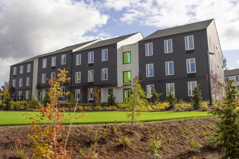
Promoting housing density by allowing more apartment buildings was a major goal in the Our Salem update.
“Salem’s neighborhoods will offer a range of housing choices that meet the needs of residents of all ages, abilities, and backgrounds,” the plan says.
To do that, the city’s new zoning map expanded the areas where multifamily buildings, like apartments, can be constructed.
“For years, we’ve known that we don’t have enough land for multifamily housing out to 2035 to meet our needs,” Kim said.
Much of the expansion comes from adding places where retail businesses and other commercial enterprises can be built alongside higher-density housing in spaces that were previously only for business or industrial use.
But the plan also converts some parts of the city from single-family or residential agricultural zoning to multifamily, meaning apartment buildings can now go in areas that were once designated for homes or farming.
The changes aren’t sweeping. They’re generally a few lots or a block here and there, not whole neighborhoods.
New areas where apartments will be allowed include parcels east of Northwest Wallace Road, near Northwest Harrit Drive, several areas off Southeast Baxter Road east of Southeast Commercial Street, and several parcels just north of Southeast Kuebler Boulevard and just west of Interstate 5.
Kim said these changes will likely be visible earliest to Salem residents.
“We’ve already started seeing development applications, for example, for developments that are under the new zones,” Kim said.
More housing along major arterials and transit corridors
Along with converting more residential land to apartments, the new plan allows them to go in along Salem’s major streets on land previously to limited to commercial uses.
By expanding mixed use zones — where retail businesses, offices and apartments are all allowed — the city hopes to create more walkable areas and make it easier for people to live in areas well-served by city buses.
The plan also requires new development in these areas to include more features for pedestrians, like plazas or outdoor seating areas.
“Mixed-use centers and corridors are intended to be walkable areas that are well connected to adjacent residential areas by the pedestrian and bicycle network,” the plan says.
Areas that are now mixed use include Northeast Market Street west of Interstate 5, much of Northeast Lancaster Drive, Northeast Fairgrounds Drive from Northeast Sunnyview to Silverton roads, much of the Broadway area between Northeast Commercial and Northeast Broadway streets, several blocks along Northeast 12th Street south of North Salem High School, most of Southeast Commercial Street, and several blocks off of Northwest Wallace Road south of Northwest Glen Creek Road in the Edgewater area of west Salem.

Neighborhood hubs
To make it easier for residents to run errands without getting in a car, the plan adds a dozen small “neighborhood hub” zones in otherwise residential areas across the city.
The zones, typically one intersection, allow clustering of restaurants, bars, retail stores (except liquor, mariuana and tobacco retailers and pawn shops), community centers, medical offices or fitness venues like yoga studios or martial arts schools.
They’re scattered across Salem and can be viewed on the city’s updated zoning map — typically small brown squares in the mostly yellow areas denoting residential neighborhoods.
Future transportation plans
Kim said the updates to the city’s comprehensive plan also lay the groundwork for another major planning project – Salem’s master transportation plan.
The transportation plan spells out how the city will invest to move cars, bikes and pedestrians, and is the guiding document used to determine which road projects get funded, and how street improvements are made.
The plan, for instance, guides whether a road in need of repair might be merely repaved, or reworked to provide more space for bikes, or a turn lane for vehicles.
Updating that plan is Kim’s next project, scheduled to kick off in 2023. She said the priorities that emerged during the Our Salem update, including more infrastructure for bikes, pedestrians and transit, as well as more of a focus on combatting climate change at the city level, will carry over into the transportation update.
Contact reporter Rachel Alexander: [email protected] or 503-575-1241.
JUST THE FACTS, FOR SALEM – We report on your community with care and depth, fairness and accuracy. Get local news that matters to you. Subscribe to Salem Reporter. Click I want to subscribe!

Rachel Alexander is Salem Reporter’s managing editor. She joined Salem Reporter when it was founded in 2018 and covers education, economic development and a little bit of everything else. She’s been a journalist in Oregon and Washington for over a decade and is a past president of Oregon's Society of Professional Journalists chapter. Outside of work, you can often find her gardening or with her nose buried in a book.