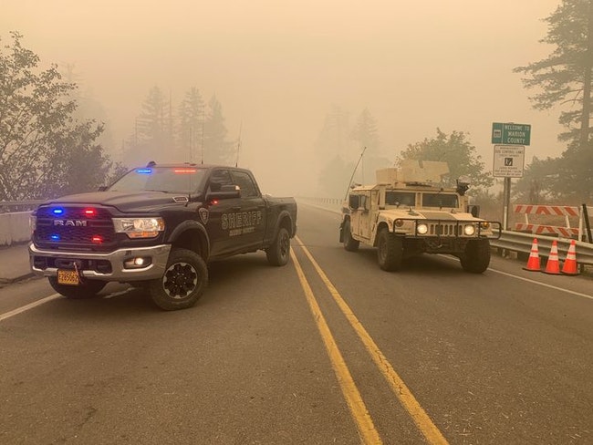


Teams from the Marion County Sheriff’s Office and the Oregon National Guard staff a roadblock on Friday, Sept.11, to prevent unauthorized access to closed fire areas. (Marion County Sheriff’s Office photo)
UPDATE 1 p.m. SATURDAY: Marion County Sheriff Joe Kast said the evacuation level was being reduced for several Marion County communities on Saturday afternoon. These communities go from a Level 2 – be ready to go – to a Level 1: Stayton, Sublimity, Aumsville, Silverton, Mt. Angel, Meridian Road south to Cascade Highway, west of Davis Creek, and west of Victor Point south to the Marion County line.
The Marion County Sheriff’s Office announced the discovery of two more victims of the Beachie Creek Fire, bringing to known toll of the out-of-control fire to four.
Sheriff Joe Kast said that as of Friday evening, 10 people were unaccounted for.
He confirmed that authorities have identified two victims on North Fork Road as 71-year-old Peggy Mosso and her grandson, 13-year-old Wyatt Tofte. Their bodies were found in a vehicle.
Kast released no information about the other two victims.
“Due to treacherous conditions, recovery efforts will be underway once a safe plan can be put into place,” Kast said.
Andrew Phelps, director of the state Office of Emergency Management, said in a Friday briefing for reporters that Oregon is anticipating a “mass fatality incident.” State officials said they would release details on injuries, deaths and structures lost when search-and-rescue missions and assessments are done.
The Oregon State Police by Friday said it had reports of “dozens” of missing people, but an accurate count was challenging because people fleeing fire zones have taken refuge in shelters, hotels, with relatives or friends.
Here is an update on other elements of Oregon’s wildfires:
FIRE CONDITIONS:
Gov. Kate Brown announced Friday afternoon that 1 million acres had burned so far in Oregon’s current wildfires – twice the total yearly average over the past 10 years. That equates to 1,500 square miles.
As of Friday night, the Beachie Creek Fire had covered 186,988 acres with some movement to the north and the south. The fire had not merged with the large Riverside Fire burning in Clackamas County.
Fire officials said they were dealing with about 200 miles of “unchecked perimeter” and spotting fires as far as 1,000 feet beyond the fire’s edge. They reported 532 people at work on the fire.
The official website for the Beachie Creek Fire said containment isn’t expected until the end of October.
FIRE RESOURCES:
President Donald Trump has approved a federal emergency declaration for Oregon, meaning additional firefighting resources will be headed to Oregon.
Adjutant General Mike Stencel of the Oregon National Guard at a Friday afternoon briefing detailed military support for the wildfire efforts:
•100 Guardsmen will help staff traffic control points to tighten access to evacuated areas that are closed to the public.
•3 teams of 125 Guard members were to head to fire camps in Clackamas, Lane and Klamath counties starting Saturday.
•He has requested 12 20-person fire crews from the National Guard in other states.
WEATHER
Salem and the Willamette Valley are under a dense fog advisory through 11 a.m. Saturday, according to the National Weather Service. The mix of fog and smoke will reduce visibility to less than a quarter of a mile.
The forecast said there would be “widespread smoky conditions with smoke layers aloft, keeping little if any sunshine from reaching the ground.” Winds will be light.
Rain is expected by Monday, with an 80% chance by Monday night.
The U.S. Air Quality Index as of Saturday morning put Salem at 175, a significant improvement over Friday’s 456. The current level in Salem is classified as “unhealthy.” The air quality remained “hazardous” Saturday morning in other Willamette Valley cities, including Silverton (516), Turner (437) and Lyons (478).
EVACUATIONS
Fire officials said 11,365 people have been evacuated from fire zones in Marion County and another 7,698 from Linn County.
The Federal Emergency Management Agency dispatched 15 truckloads of food, cots and other emergency supplies to Oregon.
The evacuation status in Marion County remains unchanged from Friday.
Current Level 2 evacuations, meaning residents should be ready to go at a moment’s notice, are in effect for Stayton, Sublimity, Aumsville, Silverton, Mt. Angel, Cascade south of Abiqua Road north of Silverton, and all areas south of Abiqua Road.
Current level 3 evacuations, meaning residents should have evacuated the area, are in Lyons, Mehama, Detroit, Mill City, Gates, North Fork Area, Breitenbush, Scotts Mills, Idahna and both sides of 214 north of Silver Falls State Park to Drakes Crossing. This includes Grade Road, Ridgecreek and Powers Creek Loop.
Marion
County’s latest evacuation map is HERE.
RECOVERY
“We know that hundreds, perhaps thousands, of Oregonians have lost their homes,” Brown said in her Friday afternoon briefing with reporters. She said finding housing for displaced people will be “extremely challenging” in part because there is an “already challenging housing situation throughout the state.”
She said she was “absolutely committed” to getting help for those who lost their homes, and that federal help is likely for those who were uninsured or underinsured.
“This is going to be a long-term recovery operation,” said Phelps. “Long-term recovery is going to last years.”


